Cheshirepedia
  • HOME
  • SEARCH
    • Photo Search
    • Photo Archive
    • Essay Search
    • Search A-Z
  • WHAT’S NEW?
    • Recent Articles
    • Cheshire and the Civil War
    • Events and Projects
  • ABOUT US
    • Donors
  • GET INVOLVED
    • Join Email List
    • Contact Us
    • Donate
    • Volunteer
  • FOR TEACHERS & STUDENTS
  • AUTHORS’ INFORMATION
    • Writing an Entry/Essay
    • Submitting an Entry/Essay
    • Contact Us
    • Choosing a Topic, Length of Entries and Essays
    • Subject Matter 1
    • Subject Matter 2
    • Guidelines for Authors
    • Cheshirepedia Style Sheet
    • What Material Requires Permission?

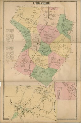
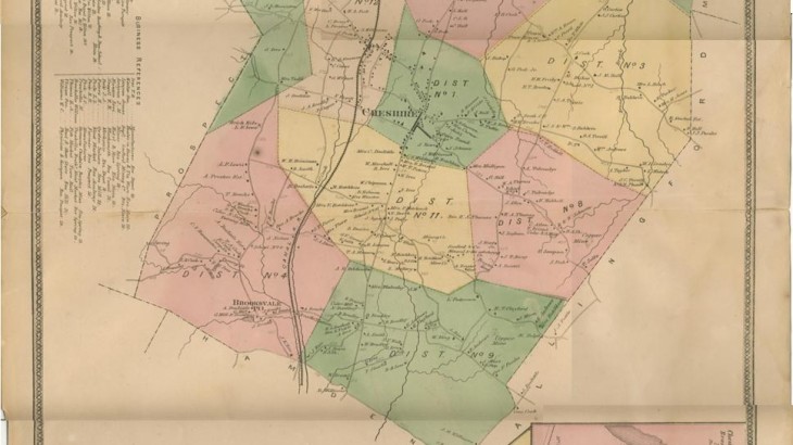
F.W. Beers Map of Cheshire, 1868

May 10, 2017May 10, 2017 John Fournier
Share

print

Uncategorized. permalink.

Post navigation

Trestle Bridge, Mixville Rd.
Cheshire (Episcopal) Academy cadets at drill, 1868

Recent Entries

  • RECOLLECTIONS OF CHESHIRE IN THE 1950’S
  • Dr. Robert L. Chesanow (1935-2018) Cheshirepedia founding member and contributor
  • Farmington Canal Talk on July 17, 2018 7pm Cheshire Public Library
  • Farmington Canal Talk
  • In Remembrance of Lee Pelz (Mrs. Seymour Pelz)

Recent Comments

  • James Foerster on Photo Search
  • Charles Dimmick on Cheshire Timeline – Cheshire History
  • Jack Brooks on Subscribe
  • agnes Wnuk on RECOLLECTIONS OF CHESHIRE IN THE 1950’S
  • Elizabeth Sullivan on RECOLLECTIONS OF CHESHIRE IN THE 1950’S
Search for:
Cheshirepedia All rights reserved. Theme by Colorlib Powered by WordPress